
|
dharmatreez
Dec 16, 2007, 3:37 PM
Post #1 of 41
(23595 views)
Shortcut
Registered: Oct 25, 2005
Posts: 228
|
Hi PA climbers!
I decided to make a quick overview map to help me work on my area maps over the winter. It is a working copy for now, areas that we haven't had a chance to get to could be on the wrong side of a stream, road, etc...
Any feedback would be greatly appreciated and it will edited for accuracy before it is finished in the spring. Current access issues would certainly be appreciated.
I had to downgrade/size to fit the upload limits on RC, just send me an email (yellowgekohikes@yahoo.com) and I will send you whatever file size you would like.
other sizes available...
Original - 36" x 62" (4.69mb) - how big is your printer...?
Gear Room Wall - 28" x48" (2.91mb)
Travel Map - 21" x 36" (1.68mb) - smallest readable size with good resolution

Long Happy Trails and Safe Climbing,
Jae
(This post was edited by dharmatreez on Jun 4, 2009, 4:08 PM)
|
|
|
|
|
kyote321
Dec 16, 2007, 4:26 PM
Post #2 of 41
(23573 views)
Shortcut
Registered: Apr 24, 2005
Posts: 636
|
Wow! great work. it is cool to see how the areas go with the Appalachian's contours.
|
|
|
|
|
crimpstrength
Dec 16, 2007, 5:16 PM
Post #3 of 41
(23543 views)
Shortcut
Registered: Nov 10, 2004
Posts: 285
|
Really nice job.
Not to be rude but I would have Tilbury as yellow - the houses on either side of the trail to lower tilbury are very friendly but the folks in the house across the street can be moody. What has worked for me: approaching the landowners, introducing myself, being friendly, telling them I appreciate the use of the "beautiful natural area," and thanking them for allowing me to park.
Basecamp PSU? Are you in state college? Are you involved with Outing Club, if so we probably know each other.
|
|
|
|
|
elwood54
Dec 16, 2007, 6:07 PM
Post #4 of 41
(23525 views)
Shortcut
Registered: Jul 8, 2005
Posts: 101
|
looks great, thanks for your work!
|
|
|
|
|
dharmatreez
Dec 16, 2007, 6:54 PM
Post #5 of 41
(23505 views)
Shortcut
Registered: Oct 25, 2005
Posts: 228
|
thanks for all the compliments
thanks too for the heads up on Tilbury, i was hoping to get some current feedback on such things, certainly not being rude at all
Basecamp PSU is a regional map i'm working on that will include all areas within 50 miles of State College
i went to Penn State but was never involved with the Outing Club
be in touch, i'm still "local", just up on the Allegheny Front nortwest of town
safe climbing everyone,
jae
(This post was edited by dharmatreez on Dec 16, 2007, 6:56 PM)
|
|
|
|
|
jt512
Dec 16, 2007, 7:44 PM
Post #6 of 41
(23489 views)
Shortcut
Registered: Apr 12, 2001
Posts: 21904
|
dharmatreez wrote: Hi PA climbers! I decided to make a quick overview map to help me work on my area maps over the winter. It is a working copy for now, areas that we haven't had a chance to get to could be on the wrong side of a stream, road, etc... Any feedback would be greatly appreciated and it will edited for accuracy before it is finished in the spring. Current access issues would certainly be appreciated. I had to downgrade/size to fit the upload limits on RC, just send me an email (yellowgekohikes@yahoo.com) and I will send you whatever file size you would like. other sizes available... Original - 36" x 62" (4.69mb) - how big is your printer...? Gear Room Wall - 28" x48" (2.91mb) Travel Map - 21" x 36" (1.68mb) - smallest readable size with good resolution Long Happy Trails and Safe Climbing, Jae
If any image ever needed to be meatbomzed...
Jay
|
|
|
|
|
dharmatreez
Dec 16, 2007, 9:07 PM
Post #7 of 41
(23465 views)
Shortcut
Registered: Oct 25, 2005
Posts: 228
|
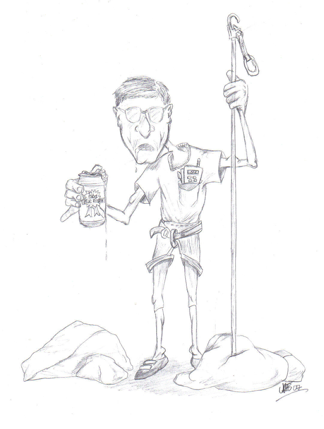
Not sure what a meatbomz is...
but i've been jaebombin' people for years,
BOOM!!
(This post was edited by dharmatreez on Dec 16, 2007, 9:08 PM)
|
|
Attachments:
|
 silverhairedsocalsportardalpha.jpg
(149 KB)
silverhairedsocalsportardalpha.jpg
(149 KB)
|
|
|
|
|
jt512
Dec 16, 2007, 10:25 PM
Post #8 of 41
(23433 views)
Shortcut
Registered: Apr 12, 2001
Posts: 21904
|
dharmatreez wrote: Not sure what a meatbomz is... but i've been jaebombin' people for years, BOOM!!
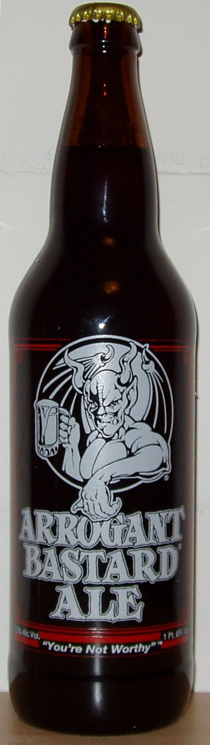
Pabst???? What's up with that?
How about...
|
|
|
|
|
Valarc
Dec 16, 2007, 11:13 PM
Post #9 of 41
(23422 views)
Shortcut
Registered: Apr 20, 2007
Posts: 1473
|
I personally prefer the Double Bastard, but that's just me...
|
|
|
|
|
gblauer
Moderator
Dec 17, 2007, 12:59 PM
Post #12 of 41
(23345 views)
Shortcut
Registered: Oct 4, 2002
Posts: 2824
|
I think Birdsboro should be "green", the land is owned by the National Lands Trust and they allow rock climbing.
Also, you can add "Swedish Cabin" in Drexel Hill, PA (near PHL). There is a small, accessible ("grren") crag. Good for an afternoon, although the last time we were there, it was filled with trash, broken glass etc.
(This post was edited by gblauer on Dec 17, 2007, 1:02 PM)
|
|
|
|
|
dharmatreez
Dec 17, 2007, 1:14 PM
Post #13 of 41
(23333 views)
Shortcut
Registered: Oct 25, 2005
Posts: 228
|
hi Gail
that is GREAT to hear about Birdsboro being on public land!
it is one of those places i was wishing i could include in my PUBLIC LAND guide.
Thanks!
everyone,
...i'm gathering all this feedback and will post soon (there is alot coming in from emails too)
Thanks again,
Jae
|
|
|
|
|
crimpstrength
Dec 17, 2007, 1:49 PM
Post #14 of 41
(23314 views)
Shortcut
Registered: Nov 10, 2004
Posts: 285
|
Jae,
You deserve all the thanks. That is really great work with the map.
|
|
|
|
|
joeforte
Dec 17, 2007, 2:03 PM
Post #15 of 41
(23308 views)
Shortcut
Registered: May 9, 2005
Posts: 1093
|
That's definately a good start. Some local input should get you some more dots. The northeast is definately lacking a lot of dots, just from a glance, but a lot of the areas are on private land/ abandoned mines.
Two things, first, it's hard to tell the magenta colored dots from the red dots.
Second, Stoney ridge is EAST of the lehigh river. You can put the dot in Bowmanstown, PA.
BTW, I'm the guy that was at the boxcar rocks cleanup with rob. I think we met there right?
|
|
|
|
|
truello
Dec 17, 2007, 2:59 PM
Post #16 of 41
(23283 views)
Shortcut
Registered: Oct 1, 2006
Posts: 737
|
I should've pointed these out earlier but I just noticed now...
Breakneck Rocks should be right where Casparis is now (closer to 119, south of 982).
Casparis should be where Lost Crag is (south Connellsville, north of the Youghiogheny/Railroad tracks).
Lost Crag is almost exactly south of Casparis, approximately 4.5 miles (other side of Yough/railroad tracks).
I am still unsure about Krahlick.
(This post was edited by truello on Dec 17, 2007, 3:04 PM)
|
|
|
|
|
charley
Dec 17, 2007, 8:04 PM
Post #17 of 41
(23214 views)
Shortcut
Registered: Apr 13, 2002
Posts: 6627
|
Krahlic is closed now anyhow.
|
|
|
|
|
dharmatreez
Dec 18, 2007, 3:45 PM
Post #18 of 41
(23161 views)
Shortcut
Registered: Oct 25, 2005
Posts: 228
|
Hi Joe
Nice to hear from you. Yeah that was me swinging the wizzle at Boxcar. Wish I would have had time to climb, still haven't tried out the "pebbles" there.
You guys need anymore help with clean up or trails don't hesitate to be in touch.
Your right at the scale on RC the magenta and red dots are hard to tell apart, it's much better at normal resolution. We're considering different colors and more catagories as well when it is finished up.
It might be usefull to designated the areas only good for bouldering from those with bigger climbs as well.
Thanks for the feedback.
Jae
|
|
|
|
|
dharmatreez
Dec 18, 2007, 3:57 PM
Post #19 of 41
(23153 views)
Shortcut
Registered: Oct 25, 2005
Posts: 228
|
OK, here is the feedback (email, pm, forum) so far:
- Breakneck Rocks - should be where Casparis is...
- Casparis - should be where Lost Crag is (north of tracks)...
- Lost Crag - directly south of Casparis (other side of tracks)
- Haycock - on rt313 between Quakerstown and Doylestown
- Pinnacle - just north of Pulpit (they are 1 mile apart on AT)
- Birdsboro - PUBLIC LAND!!!
- Stoney Ridge - east side of Lehigh River by Bowmanstown
- Chickies - on the east shore
- Rocky Ridge - north of rt30 just below "h" in Hallum
- Safe Harbor - on the east shore
- Tucquan Overhangs - move SW to the "u" on Pequea
I knew there would locations issues, the final copy will have the dots placed by the best GPS coordinates I can find for the areas.
Thanks again for all the feedback (that includes you too Jay - what would we do without you stumbling around drinking your ale, calculator in pocket, and looking for someone to "stick-clip").
Long happy trails and safe climbing,
Jae
(This post was edited by dharmatreez on Dec 18, 2007, 4:00 PM)
|
|
|
|
|
bergman
Dec 19, 2007, 4:08 PM
Post #20 of 41
(23066 views)
Shortcut
Registered: Jun 3, 2003
Posts: 13
|
Great job!
I understand that you've put a lot of work into this, but have you considered using a interactive format (ie., googlemaps) instead of having a jpg as the final result? The JPG looks great as a poster, but it's static and requires a lot of effort to update.
See:
http://maps.google.com/maps/ms?ie=UTF8&hl=en&msa=0&msid=116289982088556420644.000001134e4f0ebd9d478&z=9&om=1
for an example of what's been done with google maps & climbing in PA (it's not my work).
|
|
|
|
|
truello
Dec 19, 2007, 5:49 PM
Post #21 of 41
(23030 views)
Shortcut
Registered: Oct 1, 2006
Posts: 737
|
I think what Jae has now is awesome. I've seen hundreds of Google Maps mashups with climbing spots, and they're great.
But what I like about this is its ability to be printed to hard copy nicely.
|
|
|
|
|
dharmatreez
Dec 19, 2007, 11:56 PM
Post #22 of 41
(23007 views)
Shortcut
Registered: Oct 25, 2005
Posts: 228
|
actually Andy (Truello) has talked to me in past about using similar formats, and i do have that in mind apart from this.
i guess it's my background in art but i prefer hard copies in my hand. there's nothing like spreading out a dozen large maps in front of you on the floor and planning a trip.
this was just a quick copy to put up on my wall for note taking, something to thumbtack, post-it, and mark the 'ish out of, and i thought i would share it in it's rough form
i plan on hand drawing in all the generic logos and vegetation i threw on and possibly using the line the Delaware River makes to draw in a rock wall on the jers' side with a climber on it heading from Philly to NY, so it is more meant to be on a wall when it is finished (well, at least mine...)
but the data could certainly be transferred to an interactive format, that would only really take the raw GPS data, and my list is unfortunately not complete for all of the areas on the map. there might be some that are close already out there.
thanks for the feedback
long happy trails and safe climbing,
jae
|
|
|
|
|
crimpstrength
Feb 14, 2008, 1:49 AM
Post #23 of 41
(22461 views)
Shortcut
Registered: Nov 10, 2004
Posts: 285
|
Ok I know there is probably a better spot for this but I will put it here first.
On your map, you have two areas in Blair County that are shown with decent access - Ganister and Pinnacle. I searched the route database for information on how to get there and found nothing. Any help with these two areas?
Thank you
|
|
|
|
|
dharmatreez
Feb 15, 2008, 12:33 AM
Post #24 of 41
(22419 views)
Shortcut
Registered: Oct 25, 2005
Posts: 228
|
Ganister is quarry walls along the Lower Trail (Rails to Trails) just south of Williamsburg. There are several quarries along the left as you head towards Alexandria. Some are clearly posted and off limits, others are not. All are overgrown and there is alot of loose rock with no real current activity but there are some manky hardware you can see here and there, I've only wandered around while stopped for a break on my bike.
WATCH OUT for copperheads, I've seen a few on the top of the quarries.
Pinnacles is a tower that is right at the edge of the Juniata River north from Williamsburg on the Lower Trail heading towards Canoe Creek State Park. It unfortunately is on the opposite shore from the trail. Might be possible to take an inflatable, it's less than a mile from the Williamsburg trailhead. I rode by it for years wondering if there is any lines up it. Last winter I found out that there is a few lines on it from an old Bellefonte Quarry head. I've just never had the chance to get there since.
Hope that helps, sorry its all observation and no real beta.
Long happy trails and safe climbing,
Jae
|
|
|
|
|
blubeard
Mar 6, 2008, 7:09 PM
Post #25 of 41
(22233 views)
Shortcut
Registered: Jun 21, 2007
Posts: 26
|
First off, nice work. Thanks for distributing it.
Maps are difficult. They are especially difficult if you don't want to be continually updating them. Obviously the GPS coordinates on RC aren't always good or even available, so this type of map is real nice! The problem is that unless you make it modifiable online, it can never be updated by anyone but you. Also, google maps can be easily printed with directions, etc. making them extra useful.
I you want to continue to modify you map, try out his google map, it has some spots you haven't yet added.
http://maps.google.com/...1602&t=p&z=8
|
|
|
|
|
synrock
Mar 8, 2008, 7:33 PM
Post #26 of 41
(6701 views)
Shortcut
Registered: Mar 17, 2004
Posts: 282
|
"old Bellefonte Quarry head. "
Youngster, what is with the deal with this? Now if you really want information for your map you ain't gonna get it by this disrespect.
I am pleased to tell you that you are missing most of PA's good bouldering areas.
You don't have Elk (north of quehanna highway) listed? Dude, everyone knows about that place.
And what about Green Lane? Squirrel rock? The Rim?
And of course the 'World Class" bouldering areas are missing, J-town, G-town, and G2.
Let's start with the innacuracies.
That Pinnacle is called Indian rock by the locals or the Pennsylvania pinnacle by climbers. There is a mixed 5.9 on the west face that is classic.
Captain Jack? There is a bouldering area just off 22 near 655 called the 22 boulders but there isn't any rock at that captain jack location.
Phantom rocks is close to big rocks. I have no idea if there are rocks where you list phantom rocks at but that isn't phantom rocks. You have to realize that Rob Holtzman is incapable of admitting that he doesn't know everything which is why he made up that phantom rocks entry in the database. He makes up stuff a lot.
Black Bear rocks is just called Bear Rocks. This has been the Penn State boulderer's second main bouldering area besides Hunters for over 15 years. Too bad it is now closed. If there is a second area called Black Bear Rocks I;d like to see it.
There are no Wolf rocks.
The Dubois area "Turkey Foot?" is called the Michael Jackson crag. The earlier Penn Sate gang (circa 2000) was the first to boulder there.
You are missing a lot locally.
You should list Goodman Quarry near water street. 3 Steep LONG 5.11a sport climbs.
The Bionic Bear Claw pinnacle (12a sport) just south of pulpit rocks.
Why no Huntingdon rocks? A very old and established area along the Juniata north of Huntington.
And there is a LOT of stuff near Williamsburg not listed.
|
|
|
|
|
dharmatreez
Mar 9, 2008, 1:47 PM
Post #27 of 41
(6676 views)
Shortcut
Registered: Oct 25, 2005
Posts: 228
|
hi Jim
no disrespect meant about the "old" thing, sh*t, when someone I meet hears I'm from the State College area, the next thing they usually say is, "do you know that old bellefonte quarry guy, Jim?" (which I don't)
plus, I know I got you beat, I was twice as old as the last two people I was out climbing with 
thanks for the info on what's off, it's added to the edit list
hey, you want all of those great bouldering areas on the map, send or post some GPS coord., I'll add them to the list
it's just a working copy, I want to hand draw on the final work and get rid of the stupid clip art
I'm glad I posted it though, the critique has been and is great!
Long happy trails and safe climbing,
Jae
|
|
|
|
|
roclimb
Mar 19, 2008, 9:08 PM
Post #28 of 41
(6608 views)
Shortcut
Registered: Nov 27, 2001
Posts: 452
|
Hi Jim,
Yes, I do make up a lot of stuff. In fact I finally finsihed making up a 400 page guidebook for PA. I didnt include a lot around state College because its closed and I didn't think a lot of the stuff there and Laurel ridge near J-town, and chestnut ridge was good enough to put in a guide. Don't get me wrong there is nice stuff, just unclean and mossy. I do plan to put a lot of that stuff on my webpage in the near future. It is pretty cool rock, just needs to be traveled more.
Jason,
Goodman quarry is small but a nice place to visit for an afternoon. It's off "the Lower Trail" (rail Trail) off rt 22 near huntington. Find the intersec. of 453 and 22 and go sout a short way on teh trail. The quarry is near Goodman road and canal channel. Owens quarry is there too but not good for climbing.
Sand Road has nice boulders down a ways in south west PA. There used to be some vid of some boulders there on synrock. Those were cool vids Jim, they still up? you should put more up on the site. seriously, I know PA climbers enjoy that stuff.
Hobo Hill is a nice spot also. Is that on the map?
There are several wolf rocks in PA. The closest I can think of to central pa is prb. on Laurel ridge on the wolf rocks trail west of Johnstown.
FYI....I have never and will never claim to know all of the rock in PA. I don't think anyone can claim that. There is just too much rock! We are lucky to have so much in PA.
For Phantom rocks, its off Peacock Rd. in the state forest near Lock Heaven. Any outing club member from LHU can tell you where it is since they frequent the spot regularly...it is, in fact, very close to the U.
Happy climbign to all
~Rob
(This post was edited by roclimb on Mar 19, 2008, 9:12 PM)
|
|
|
|
|
dharmatreez
Mar 20, 2008, 3:00 AM
Post #29 of 41
(6585 views)
Shortcut
Registered: Oct 25, 2005
Posts: 228
|
Hi Rob
Yeah, I feel stupid, I've ran or rode my bike past Owens and Goodman so many times in the last 5 years. Owens is the first quarry on your right (there is a wooden sign). I scrambled up in Owens but found only loose, dangerous, short walls a few years back. I'll have to check out Goodman further down the trail next time, I know exactly which one it is now.
Hobo is on the map.
Yeah there is Wolf Rocks down by Ogletown in Gallitzin State Forest on the John P. Saylor Trail, I believe that is what you are talking about. LOTS of graffiti!! Spent a night there during a backpack a few winters ago, but never have climbed anything.
I also included Wolf Rocks in Moshannon State Forest that is right on the Allegheny Front Trail. The boulders were mossy and maybe 20' was the max and very few. I thought if a backpacker/climber knows that they are there, maybe they would want to throw some shoes and chalk in their pack.
--
Just a little more work to do and I'll have the final one finished.
Again thanks for all the help and criticism from everyone!
Jae
|
|
|
|
|
synrock
Mar 20, 2008, 5:20 AM
Post #30 of 41
(6572 views)
Shortcut
Registered: Mar 17, 2004
Posts: 282
|
Never heard of sand road. I have quite a few videos of sw pa gritstone on the synrock web site.
Have you ben to Hobo hill? We've probably put up 40 good problems there.
I'm not sure if I would call a 150 ft vert to overhanging cliff in PA "small" - have you been to goodman quarry?
I believe there are 2 phantom rocks - the one I am thinking of is q good drive from loch haven and not off peacock rd.
As to how much rock there is in pa - especially bouldering - it's freaking amazing.
Lately I've been going to a undeveloped new diabase area that is basically another Gretna - size and rock wise.
First ascent of diabase highballs is always intense - luckily I only broke one hold on this arete-roof problem. The amazing face to the left is very virgin.
|
|
Attachments:
|
bowersoldgoatweb.jpg
(141 KB)
|
|
|
|
|
roclimb
Mar 20, 2008, 6:16 PM
Post #31 of 41
(6547 views)
Shortcut
Registered: Nov 27, 2001
Posts: 452
|
Jim,
Wow, that stone looks awesome!
Is that part of the "diabase belt" that runs out into the SWPA part of the state, near where the belt ends?
~Rob
|
|
|
|
|
Valarc
Mar 20, 2008, 6:36 PM
Post #32 of 41
(6532 views)
Shortcut
Registered: Apr 20, 2007
Posts: 1473
|
This seems like as good a place as any to ask...
It seems to me most of the "best" bouldering locations I've read about in PA tend to be central/western PA (stuff like Hunters). I've never actually climbed outdoors in the keystone state, but I do have family there, and would love to skip out of some boring family crap to do some bouldering.
What are some really great bouldering spots on the east side of the state? Anything near Philly would rock, and something within an hour or so of York wouldn't be bad. Stuff near Harrisburg would be good too, as I'd have a place to crash. Any thoughts?
|
|
|
|
|
synrock
Mar 20, 2008, 7:57 PM
Post #33 of 41
(6516 views)
Shortcut
Registered: Mar 17, 2004
Posts: 282
|
roclimb wrote: Jim, Wow, that stone looks awesome! Is that part of the "diabase belt" that runs out into the SWPA part of the state, near where the belt ends? ~Rob
Of course it's part of the diabase belt - right in the middle - close to where you live.
More photos - the only disadvantage to the place (besides the fact it is basically gretna with no trails) are the mararding packs of territorial goats.
These guys climb up to v2 and have a nasty tendancy to challange you king of the mountain style right when you are in the middle of one of those desperate top outs.
We've found the best defense is to throw your chalk ball at them and goats being goats they try to eat it and get a nasty case of cotton mouth and run off to get a drink. This maneuver has saved my ass on more than one occasion but be sure to take extra chalk balls because sometimes they gang up on you.
bowers
|
|
Attachments:
|
goatrockgoat.jpg
(135 KB)
|
|
|
|
|
truello
Mar 20, 2008, 9:50 PM
Post #34 of 41
(6492 views)
Shortcut
Registered: Oct 1, 2006
Posts: 737
|
Haha that picture just made my day
|
|
|
|
|
synrock
Mar 20, 2008, 10:13 PM
Post #35 of 41
(6485 views)
Shortcut
Registered: Mar 17, 2004
Posts: 282
|
more photos of goat rocks.
|
|
Attachments:
|
goatrockA.jpg
(146 KB)
|
|
|
|
|
synrock
Mar 20, 2008, 10:16 PM
Post #36 of 41
(6484 views)
Shortcut
Registered: Mar 17, 2004
Posts: 282
|
This is an amazing v3-4 slab.
|
|
Attachments:
|
goatrockb.jpg
(89.3 KB)
|
|
|
|
|
joeforte
Mar 20, 2008, 10:23 PM
Post #37 of 41
(6482 views)
Shortcut
Registered: May 9, 2005
Posts: 1093
|
Valarc wrote: What are some really great bouldering spots on the east side of the state? Anything near Philly would rock, and something within an hour or so of York wouldn't be bad. Stuff near Harrisburg would be good too, as I'd have a place to crash. Any thoughts?
Well consider yourself lucky. Haycock mountain is located north of Philly, and has some of the best bouldering in the state. Check out Rob's site www.paclimbing.com for an online guidebook to hangar 18, one of the areas at haycock. His site is still very new, so expect to seem more onilne guides in the future.
|
|
|
|
|
HarklessDO
Mar 21, 2008, 8:10 PM
Post #38 of 41
(6450 views)
Shortcut
Registered: Jan 29, 2007
Posts: 159
|
Not really the place but congrats on getting the new rockpodz in climbing magazine and the nice review.
|
|
|
|
|
roclimb
Mar 24, 2008, 2:43 PM
Post #39 of 41
(6409 views)
Shortcut
Registered: Nov 27, 2001
Posts: 452
|
Joe,
thanks fo rthe PR.
Jim,
That is funny as heck. Place looks cool. It isnt near Reading by chance is it?
|
|
|
|
|
synrock
Mar 24, 2008, 6:04 PM
Post #40 of 41
(6380 views)
Shortcut
Registered: Mar 17, 2004
Posts: 282
|
Well reading is right in the middle of the belt isn't it?
|
|
|
|
|
dharmatreez
Mar 25, 2008, 9:39 PM
Post #41 of 41
(6334 views)
Shortcut
Registered: Oct 25, 2005
Posts: 228
|
OK, here is my FINAL edit!

This is what I had in mind to hang on my wall and what I'm going to print out and put up.
The locations are approx. and there are alot more areas in PA, that's for sure.
Please feel free to email me at yellowgekohikes@yahoo.com for a full size/resolution copy. I crammed alot of info on the map and it's only really readable at full size.
There is 114 areas...
- 79 PUBLIC
- 23 Private (check access locally)
- 12 CLOSED
I'm going to tackle it again in a few years. Add more PUBLIC locations, check on current access and make the locations more accurate. A list down the side of the public areas with their GPS coord. might be nice too. I'm sure there will be plenty of ideas for improvement by then.
THANKS for all the criticism and ideas, it was a big help.
Long happy trails and safe climbing,
Jae
(This post was edited by dharmatreez on Mar 25, 2008, 9:42 PM)
|
|
|
|
|
|
|
|
|


